Coastal Mapping Property Ireland Tips 2026
Avoid costly mistakes with coastal mapping property Ireland tips. Learn how to check erosion maps before buying a seaside home.
Coastal Mapping Property Ireland Tips 2026: What You Need to Know Before You Buy Near the Shore
If you are thinking of buying a home along the Irish coast, you have probably already noticed that the market moves differently here. Cliffs, beaches, and sea views command a premium, but they also come with hidden risks that inland properties rarely face. Understanding how to read the land, the tides, and the planning rules is essential. That is where the idea of coastal mapping property Ireland tips 2026 becomes relevant, not as a gimmick, but as a practical approach to due diligence. This guide walks you through the specific factors you need to consider before making an offer on a coastal property in Ireland this year.
Whether you are looking at a cottage in west Cork, a modern apartment in Salthill, or a farmhouse near the Wild Atlantic Way, the same principles apply. Let us break them down.
Why Coastal Mapping Matters More Now Than Ever
Ireland's coastline is dynamic. Erosion, flooding, and changing weather patterns are not future concerns anymore. The CSO reported that the number of properties within 100 metres of the coastline has increased steadily over the past decade, and many of those homes face rising insurance premiums or difficulty getting mortgage approval. The OPW (Office of Public Works) has updated its coastal flood risk maps, but these are not always easy for a buyer to interpret.
That is why you need to do your own homework. Coastal mapping property Ireland tips 2026 are really about combining official data with local knowledge. You cannot rely solely on a seller's survey or a quick look at Google Earth. The tide does not lie, and neither does the history of storm damage in a specific area.
Key data sources to check:
- OPW coastal flood hazard maps (available online)
- Local authority development plans and shoreline management plans
- Irish Coastal Protection Strategy Study reports (usually from your county council)
- Bathymetric surveys where available (for properties on estuaries or tidal rivers)
If you are buying a property that is less than 50 metres from the high-water mark, you should also check if the area is designated as a Special Area of Conservation or a Natural Heritage Area. These designations can restrict renovations, extensions, or even basic maintenance like replacing a sea wall.
A Brief Real Example
In early 2026, a couple I know were close to signing contracts on a Georgian property near Courtmacsherry, west Cork. The auctioneer's brochure boasted "stunning sea views and private slipway." They decided to commission a coastal risk assessment before closing. The survey revealed that the slipway was undermining the foundations of an adjoining garden wall, and the entire rear boundary had been rebuilt three times in the past twenty years. The report noted that the property fell within a predicted 1-in-50-year flood zone. They walked away. The bank had already flagged the property for a higher deposit requirement of 30%. That is the kind of information coastal mapping can uncover.

What the RTB and Revenue Say About Coastal Rentals
If you are buying a coastal property as an investment, the rules are different again. The RTB (Residential Tenancies Board) has specific requirements for properties let on short-term or long-term leases. But the Revenue Commissioners are equally attentive to holiday homes and short-term lets along the coast. If you plan to rent out a coastal property through Airbnb or similar platforms, you must register with the RTB if the tenancy exceeds 14 consecutive days, and you must declare the income to Revenue under the new short-term letting rules introduced in recent years.
More importantly, coastal properties often have higher maintenance costs, and those costs affect your bottom line. The SEAI (Sustainable Energy Authority of Ireland) reports that homes in exposed coastal locations can have heat loss rates 15 to 20% higher than inland homes of the same size. That means a lower BER rating, which can limit your rental income potential and may even make the property difficult to let at market rates.
Practical tip: Before you buy a coastal rental property, get a BER assessment that specifically accounts for wind exposure and salt spray. Then factor the retrofit cost into your purchase offer. A C3 or lower BER will push away quality tenants and reduce your rental yield by at least 10% on average.
Five Key Factors to Map When Viewing a Coastal Property
When you go to view a coastal property, bring a notebook and a camera. You are not just looking at the house. You are looking at the landscape around it. Here are the five most important things to check.
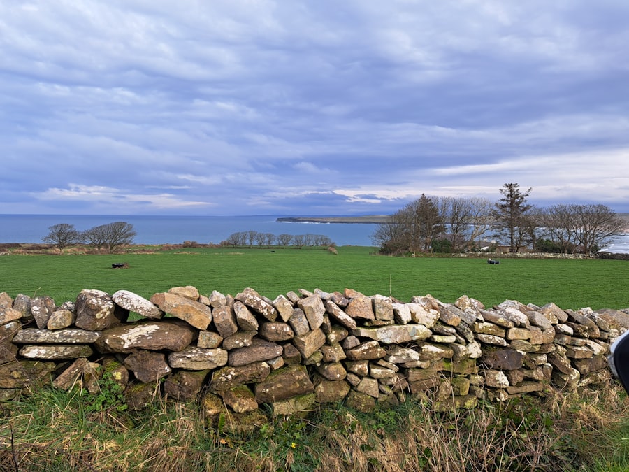
- Vegetation line. If the grass stops abruptly near the house, or if there are dead bushes fringing the garden, that is a sign of salt spray exposure. It corrodes building fabric faster than you think.
- Drainage channels. Look for recent digging or plastic piping near the foundation. Coastal properties often need extra surface water drainage to handle storm surges. A dry day can hide this problem.
- Foundation type. Is the house on a concrete slab or on piles? Piled foundations are more common in sandy coastal soils. If the house is on a shallow slab near a dune system, ask for a soil compaction test.
- Roof anchoring. Check whether the roof is strapped down with metal ties. Properties in high wind zones, especially on the west coast, should meet wind loading standards from the building regulations. Many older cottages do not.
- Access road maintenance. Coastal roads are often unadopted. If the lane is private, who maintains it? Storm damage can wash out gravel drives or break tarmac. Get that in writing from the seller.
Digital Tools That Help
You do not need to be a GIS expert. There are now several free or low-cost tools that allow you to overlay coastal erosion data onto property addresses. The Geological Survey Ireland's online viewer, for example, shows predicted shoreline change for the next 50 years. Combine that with the OPW flood maps, and you get a solid picture. For a deeper look, you can hire a coastal engineer. Expect to pay between 500 and 1,000 euro for a desktop assessment, but it can save you tens of thousands in unforeseen repairs.
Planning Permission and Coastal Setbacks
Under current local authority guidelines, any new dwelling or significant extension within 100 metres of the high water mark must undergo a coastal vulnerability assessment. This applies to both inland and coastal views. If the property is in a designated coastal zone, you may also be required to maintain a "setback" of 20 to 30 metres from the cliff edge or dune base. These setbacks are not just recommendations. They are enforced.
If you are buying a property that was built before these regulations came into effect, be very careful when planning any renovation. The local authority may impose conditions that effectively prevent you from extending seaward. In some cases, even a dormer window can be refused if it changes the roof profile and affects coastal views. My advice is to visit the planning department of the county council before you make an offer. Ask to see the coastal zone map for that area. It will tell you exactly where the line is drawn.
Internal link: For more on understanding property boundaries and planning risks, check our guide on buying property in Ireland.
Financing a Coastal Property: What the Banks Look For
Mortgages on coastal homes are not impossible, but they are more scrutinised. Banks typically require a full structural survey that includes a section on flood risk and coastal erosion. If the survey flags any issues, the lender may demand a higher deposit, a lower loan-to-value ratio, or even refuse the mortgage outright. According to the Banking & Payments Federation Ireland, the number of mortgage applications declined in coastal areas classified as high risk has increased in the past two years.
Your best approach is to arrange a pre-approval with a mortgage broker who understands coastal properties. They can advise on which lenders are still lending in specific postcodes. For example, AIB and Bank of Ireland have published coastal risk zones, while some credit unions are more flexible. Do not assume that the first bank you approach will give you a mortgage. Shop around.
If you are buying a second home or a holiday let, the deposit requirement often jumps to 30% if the property is in a high-risk coastal area. Factor that into your budget. You can find more tips on financing on our registration page where we explain how to set up a buyer profile that flags coastal properties.
Insurance Pitfalls to Avoid
Home insurance for coastal properties has become significantly more expensive and restrictive. Some insurers now exclude storm surge, coastal erosion, and subsidence caused by salt water. Others require you to install specific flood defences or to maintain a vegetation buffer. The cost of rebuilding a coastal home can also be higher because of the need for marine-grade materials. Concrete exposed to salt spray deteriorates faster. Timber rots. Steel rusts.
Before you sign any contract, get at least three insurance quotes for the property. Make sure the policy covers "coastal erosion" and "storm surge" explicitly. If an insurer refuses to quote, that is a red flag. You can use our comparison tool at Findivo Rent to see what similar coastal rentals are paying for insurance, though you should still speak directly to a broker.
Final Thoughts on Coastal Mapping Property Ireland Tips 2026
Buying near the sea is one of life's great pleasures, but it demands a different level of caution. The coastline is not static, and neither are the rules. By using the coastal mapping property Ireland tips 2026 outlined here, you give yourself a clear advantage. You will not be caught out by an unexpected planning refusal, an uninsurable roof, or a mortgage that falls through at the last minute. The key is to combine official maps, local knowledge, and professional surveys. Do that, and you can buy with confidence.
If you are currently searching for a coastal property, set up a saved search on Findivo and include the "coastal zone" filter. That way, you will only see listings that have been flagged with relevant risk data. For more guidance on the entire buying process, visit our cars and properties sections where we cover everything from deposit requirements to moving costs. The coast is waiting, but only for the prepared buyer.
Frequently Asked Questions
What is coastal mapping and why is it important for Irish property buyers in 2026?
Coastal mapping uses technology like LiDAR and satellite imagery to assess coastal risks. It's vital in 2026 as climate change accelerates erosion and flooding threats to Irish coastal properties.
How can I access coastal mapping data for a specific property in Ireland?
You can access data through the Irish Coastal Protection Strategy Study (ICPSS) maps or Ordnance Survey Ireland's online portal. Local county councils also provide flood risk assessments for property buyers.
What are the main coastal hazards to consider when buying property in Ireland in 2026?
Key hazards include sea-level rise, coastal erosion, storm surges, and flooding. Rising sea levels along the Atlantic coast make these risks more critical than ever.
Are there government grants available for protecting coastal properties in Ireland?
Yes, the OPW flood scheme and Local Authority coastal works program provide funds for flood defenses. You must have mapping evidence showing high risk to qualify.
What steps should I take if a coastal map shows my dream property is at risk?
Consider purchasing comprehensive flood insurance and avoiding low-lying areas near cliffs or tidal zones. Consulting a coastal engineer for a site assessment can also guide mitigation measures.